
Saugus ZIP Code Coverage
The research confirms one principal Saugus postal ZIP through an official post-office record. It also identifies a nearby Revere ZIP that appears on non-government maps as a possible edge case, but no authoritative polygon was located to prove Saugus land inside it. The careful approach is to label the source and the geographic unit it represents rather than treating a mailing code as a municipal boundary.
| ZIP | Areas Covered | Post Office | Notes |
|---|---|---|---|
| 01906 | Saugus postal city and much of the town | Saugus Post Office, 437 Lincoln Avenue | Official office listing confirms 01906-9998; it does not draw a parcel-by-parcel boundary |
| 02151 | Revere postal city in nearby official-office results | Not established as a Saugus post-office ZIP | Possible Saugus overlap appears on non-government maps, but no official USPS polygon confirms it |
The table does not invent a PO-box ZIP, unique ZIP, or a townwide postal polygon. The available official evidence supports 01906 as the verified Saugus Post Office ZIP. It does not settle every delivery route or every parcel near a municipal edge.
Verify Saugus ZIP Code 01906
The USPS Saugus Post Office location record identifies the office at 437 Lincoln Avenue, Saugus, MA 01906-9998, with phone 781-233-8354. The research captured weekday hours of 8:30 to 5 and Saturday hours of 8:30 to 12. Those hours can change, so use the official location record for a current check. The record verifies an office and its postal ZIP, not the exact shape of every ZIP service area.
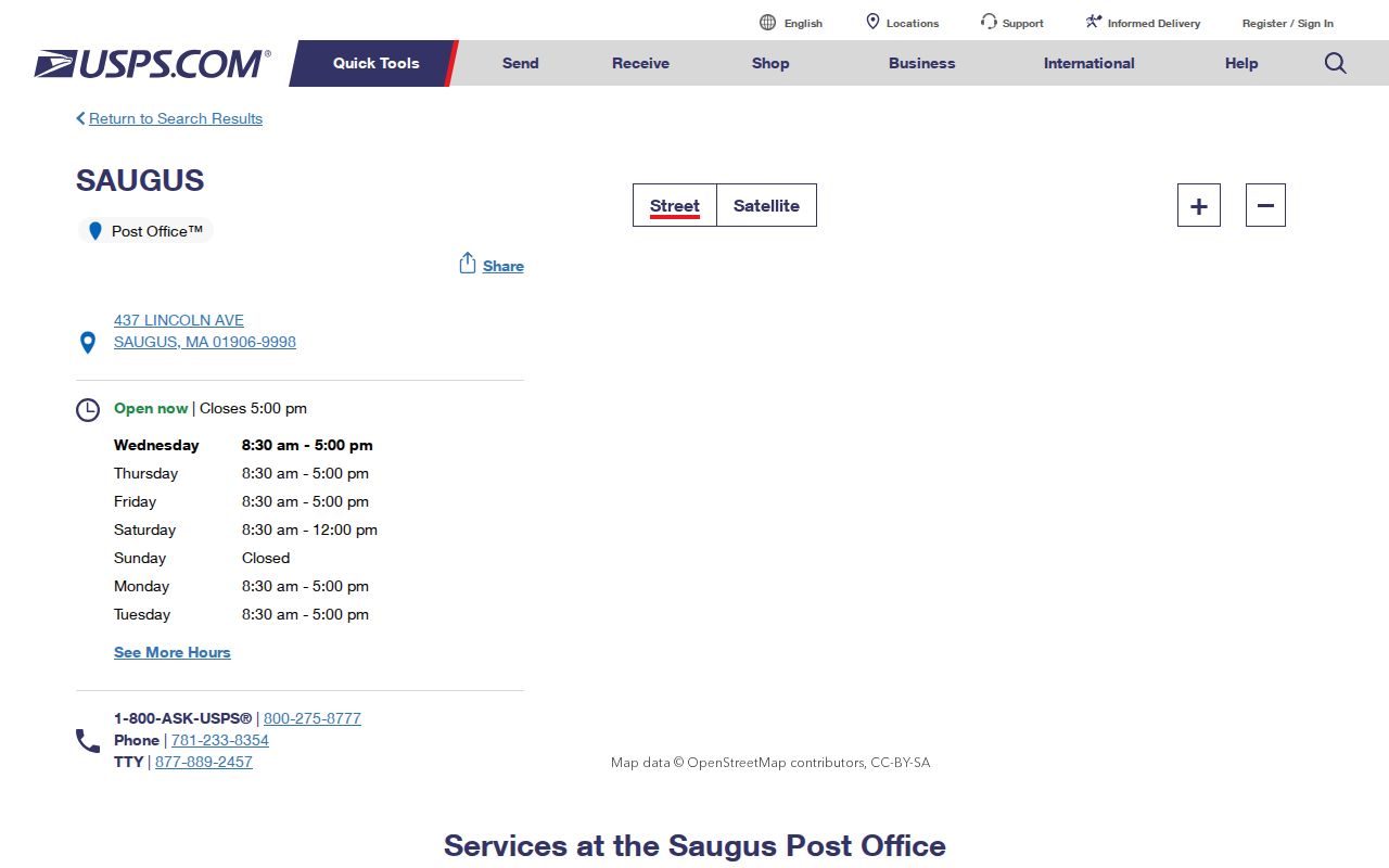
The USPS screen is a useful postal source because it supplies the office address, ZIP+4, phone, and operating details. Pair it with a town or parcel source before using a ZIP Code as evidence about a physical Saugus location.
Saugus and the 02151 Research Gap
02151 is associated with Revere in the nearby official-office results. Some non-government ZIP maps show an apparent overlap toward Saugus, yet the research did not locate an official USPS polygon that confirms Saugus land within 02151. Do not state that an official 02151 polygon covers Saugus. Treat it as a question to test against the USPS address tools, municipal boundary maps, MassGIS data, and the specific parcel record.
A nearby post office is a service clue, not a legal boundary decision. Likewise, an address using a Saugus mailing city does not alone establish that the parcel lies inside the Town of Saugus. Retain the full source address, postal city, ZIP, municipal town, and source date when an edge location is involved.
Note: A leading zero is part of the ZIP value, so store 01906 as text rather than dropping the first digit.
Saugus ZIP Codes and Town Limits
Postal and civic geography overlap but do not use the same boundaries. USPS controls mailing-address and post-office service labels. The Town and Secretary of the Commonwealth maps describe municipal and precinct boundaries. The Assessor manages the local tax roll, while Southern Essex preserves the recorded legal description. MassGIS supplies statewide layers for ZIP Codes, municipalities, roads, parcels, and precincts. A good Saugus ZIP code directory search names which one of those units the result actually describes.
- ZIP and ZIP+4
- A five-digit postal area and the extra four digits USPS uses to refine delivery. ZIP+4 is not a parcel identifier.
- PO-box ZIP
- A postal code used for box service, which can differ from the physical street address of the customer.
- Unique ZIP
- A postal code assigned to one large organization or delivery destination. None is established here as a Saugus ZIP.
- Carrier route
- A USPS delivery grouping. It can help organize mail service but does not define a town line or legal lot.
Use the term “postal ZIP” in a record note when that is all the evidence shows. It prevents a postal destination from being mistaken for a present residence, a precinct, or a legal parcel.
Map Saugus ZIP Code Layers
The MassGIS data-layer catalog provides the official statewide context for ZIP Codes, municipal limits, parcels, roads, and precincts. It is the right place to compare layers when an address is near an edge or carries an unexpected postal city. The data is geographic context, not a guarantee that a map label has settled a delivery question or a legal boundary.
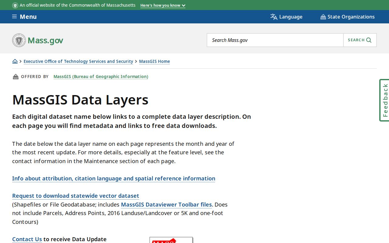
The MassGIS catalog shows why several map layers may be needed for one address. A ZIP layer answers a postal-geography question; a municipal layer and a parcel layer answer different questions and should be recorded separately.
Research a Saugus ZIP Code
ZIP Code searching in Saugus is a cross-checking task, not a single local-resident filter. Patriot’s documented advanced form has street name, street number, parcel, owner, book, and page fields, but the research did not verify a dedicated ZIP field. AxisGIS may display ZIP layers, but the live control labels were not verified in text extraction. A street and number are still enough to connect a postal check to the local parcel and map context.
- Verify the mailing ZIP and office details through the official USPS tool. Keep the result as postal evidence.
- Compare the address with MassGIS municipal, ZIP, road, and parcel layers. Note which layer gives each result.
- Search the street and number in Patriot Properties. Save the situs address, parcel ID, map grid, and assessed-name field.
- Use AxisGIS or an assessor map to compare the parcel with the road and adjacent geometry.
- For a recorded-interest question, use the parcel or book/page lead in the Southern Essex Registry. For a year-specific street list, ask the Town Clerk about the applicable access route.
Once a ZIP has narrowed the general area, use the Saugus street directory for the address-by-address workflow. A ZIP alone is not enough to choose a Saugus parcel or infer a precinct.
Saugus ZIP Research Search Fields
The documented local form is ZIP-adjacent rather than ZIP-filtered. It lets an address researcher move from a street-level result to a parcel record, then test the postal and map layers separately. The field table is more reliable than claiming a ZIP filter that the research did not confirm.
| Portal field | Type | Useful ZIP research role |
|---|---|---|
| Street name and Street num | Address fields | Find the Saugus situs parcel after a postal-address check |
| Parcel | Parcel identifier | Cross-check assessor map and related local geography |
| Book and Page | Recorded-land reference | Move from a property lead to Registry research |
| Owner | Name field | Find a tax-roll lead without treating it as a ZIP roster |
| Residential ZIP in voter form | Required five-digit text field | Individual voter-status check only, with name, birth date, and agreement |
The Massachusetts voter-status form is not a ZIP directory. It requires first and last name, date of birth, residential ZIP, and an agreement checkbox. Central-registry names and addresses are not generally public, and a missing result does not prove that someone does not live in a place.
Historic Saugus Addresses Before ZIP Codes
Many Saugus records predate ZIP Codes. The 1922 Sanborn set uses Saugus Centre, East Saugus, and Cliftondale as mapped places. The 1932 annual report also warned of four duplicate street names and non-sequential numbers. A 1930s house guide, deed, town report, or directory may be best searched through its original street form, neighborhood, precinct, map reference, and parcel chain rather than by adding a modern 01906 label.
Keep the source address and normalized address in separate fields. Add a present postal ZIP only as a labeled geocoding aid, not as though it had appeared in the original document. This simple distinction prevents an old street listing from being mistaken for modern postal evidence.
Use the Saugus ZIP Code Directory Carefully
The Saugus ZIP code directory can verify postal context, organize a map search, and help identify the right next source. It cannot settle title, define every town edge, or create a list of everyone in a postal area. A parcel card, historic directory entry, deed, town list, or map should retain its own source date and record type. That makes it possible to explain why a result differs rather than treating the difference as an error.
Practical rule. For a difficult address, save the original source address, normalized address, postal ZIP, municipal town, parcel ID or map grid, source year, and confidence note.
Contact USPS for mailing-address questions, the Town or map authority for civic geography, the Assessor for the current tax parcel, and Southern Essex for recorded land. Verify the result with the relevant custodian before relying on it.